|
|
 |
|
Outback Info (Private Seiten) © seit 1999
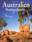
Great Tracks - Australia
Sandover Highway
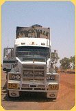
The vast open spaces along the adjoining Sandover Highway to Camooweal can
make for a memorable 4x4 trip for those who cherish the feel of the great
outdoors. Road conditions can range from good to sandy and severely
corrugated. Swirling bulldust can reduce visibility on some stretches so
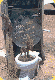
keep a safe speed and distance behind other vehicles. You can refuel at
Arlparra Store and Ammaroo Station before heading into Camooweal.
Road Surface
Earth formed.
Special Information
The highway is earth formed and is adversely affected by rain. Dust can be
hazardous in dry weather particularly when road trains encountered.
Conventional vehicle can travel this route however EXTREME caution must be
taken at all times.
Road Condition Updates
Motorists are urged to check road conditions before departure and obtain
reliable local advice en route, eg. Police or fuel stops. Road conditions
can deteriorate rapidly after heavy rains.
For all Northern Territory road conditions, phone the Department of
Transport and Works on free call (within Australia ONLY) 1800 246 199 for a
recorded message or 24 hour access to an operator. |
Plenty Highway
Head east on the sealed stretch of the Plenty Highway 70 km north of Alice
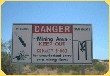
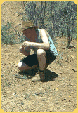
Springs for an overnight camp at delightful Gemtree where you can try your
luck at fossicking and re-stock for the journey ahead. The highway’s
remaining unsealed gravel section takes you through sprawling Barkly cattle
country to the Queensland border. Conventional cars may handle conditions on
the Territory side but 4x4 is recommended to tackle the corrugated and dusty
Queensland sectors, notably between Tobermorey and Urandangi or Boulia. Fuel
and supplies are available during daylight hours from the Gemtree Caravan
Park, Harts Range Store (closed noon-3pm) and Jervois Station.
Road Surface
First 100 kms off Stuart Highway is sealed, then graded earth formed road to
Tobermorey (QLD BORDER).
Special Information
Conventional vehicles with care. Road conditions can deteriorate into tracks.
Tobermorey through to Urandangi is a dry weather road only.
Harts Range Aboriginal Community - no permits required to visit the Store.
NO ALCOHOL allowed on community.
Road Condition Updates
Motorists are urged to check road conditions before departure and obtain
reliable local advice en route, eg. Police or fuel stops. Road conditions
can deteriorate rapidly after heavy rains.
For all Northern Territory road conditions, phone the Department of
Transport and Works on free call (within Australia ONLY) 1800 246 199 for a
recorded message or 24 hour access to an operator. |
Pioneers Path
Pioneer’s Path links the world-renowned landmarks of Central Australia as it
meanders through Australia’s interior starting at Erldunda, travelling to
Ayers Rock/Uluru and Watarrka (Kings Canyon) National Park where it joins
the Mereenie Loop through the West MacDonnell Ranges to Alice Springs.
Road Surface
Lasseter Highway is Sealed.
Luritja Road is Sealed.
Mereenie Loop is Unsealed.
Larapinta Drive
Alice Springs to Hermannsburg border is sealed. Roads past this point are
dirt & suitable for 4x4 vehicles only, including the road into Palm Valley.
Namatjira Drive
Larapinta turnoff to Glen Helen is sealed & suitable for all vehicles. Roads
past Glen Helen, including the road to Redbank, are gravel - suitable for
4x4’s only and are not serviced.
Special Information
Lasseter Highway is suitable for conventional vehicles and is well serviced.
Luritja Road and Mereenie Loop are unserviced.
Fuel on Larapinta and Namatjira Drives is only available at Hermannsburg
and Glen Helen. These roads through the Western MacDonnells pass by many
waterholes and attractions - it is worth planning your trip to take in some
attractions on the trip out and taking in the remainder on your return.
Road Condition Updates
Motorists are urged to check road conditions before departure and obtain
reliable local advice en route, eg. Police or fuel stops. Road conditions
can deteriorate rapidly after heavy rains.
For all Northern Territory road conditions, phone the Department of
Transport and Works on free call (within Australia ONLY) 1800 246 199 for a
recorded message or 24 hour access to an operator. |
|
|
|
|
 |
|
 Finden
Sie Ihre eigenen Edelsteine in Australien mit der Fossicking
CD. Finden
Sie Ihre eigenen Edelsteine in Australien mit der Fossicking
CD.
 |
|
|